This page includes some information on a planned project to recognize some geological locations in Egypt as geoparks.
This page was written by Kholoud Mohamed (project PI) and edited by Tamer Abu-Alam (project co-PI).
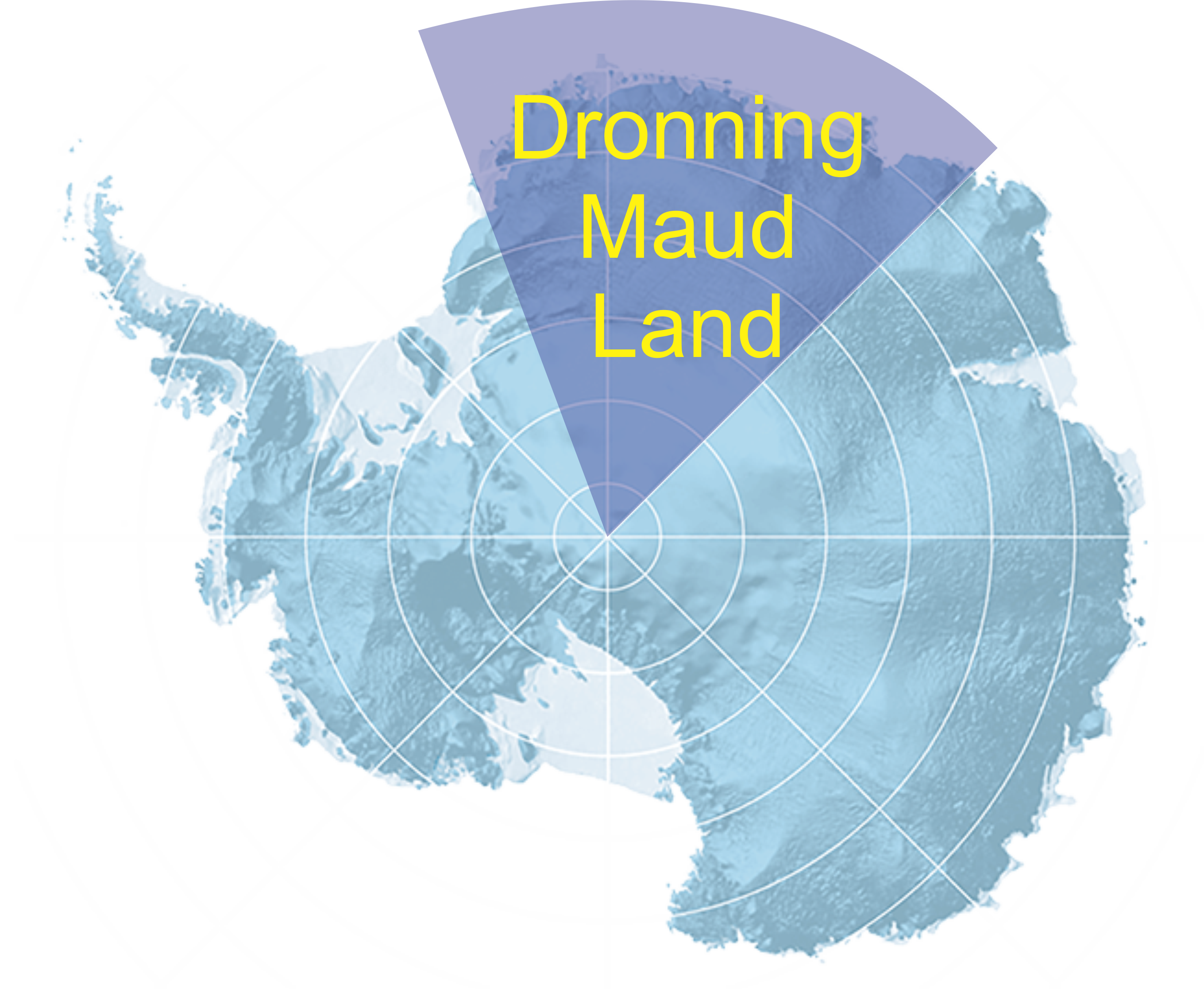
The project aims to recognize Ras Muhammad National park and Abu Roash area as UNESCO recognized geoparks.
Ras Muhammad National park
Ras Muhammad National park is Egypt’s oldest and best known protected area. The headland, overlooking the juncture of the gulfs of Suez and Aqaba at the southernmost tip of the Sinai Peninsula, is fringed by sheer cliffs of coral that descend 100 meters into the sea, affording some of the best diving sites in the world. Habitats include a mangrove community, salt marshes and intertidal flats. The park protects reefs to the east, as well as the islands of Tiran and Sanafir, breeding grounds for globally threatened seabirds and marine turtles. The park also harbors a diversity of desert mountain and Wadi habitats, gravel plains and sand dunes, and the area is an internationally important concentration point for migratory soaring birds.
ٍSt. Katherine Protectorate occupies much of the central part of South Sinai, a mountainous region of Precambrian igneous and metamorphic rock which includes Egypt’s highest peaks. The monastery of St. Katherine and mount Sinai are only two of the area’s outstanding cultural and religious heritage sites. Some 419 plant species, representing almost 40% of Egypt’s total flora, are found in the region, and nearly half of the 33 known plants endemic to Sinai are found there, many of them rare and endangered. The St. Katherine region is equally rich in fauna, with several species not found elsewhere in Egypt or the world. Bedouin communities living within the protectorate pursue their traditional ways of life, and now participate in and benefit from the activities of the protected area, as community guards, manufacturers of handicrafts, guides, and hosts for ecotourism activities.
Abu Roash area
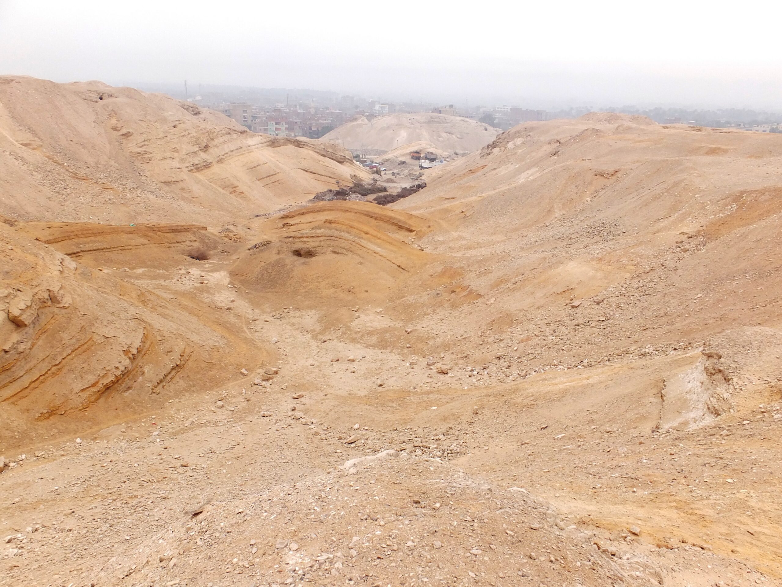
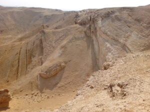
In NE Egypt the upper Cretaceous rocks lie on highly deformed and subsequently eroded Neoproterozoic basement, which was extended during Tethyan Rifting by NE-SW and ENE-WSW normal faulting that led to the formation of extensional basins elongated in those directions (Moustafa, 2019). From mid-Cretaceous time through Early Tertiary time extension continued but was oriented NW-SE. It was during this interval that sedimentation began in Abu Roash.
The exposed lithostratigraphic sequence of the Abu Roash area includes Cretaceous, Eocene, Oligocene, and Quaternary rock units. The area lies within the western end of the Syrian Arc foldbelt, which extends from northern Egypt to Syria (Krenkel, 1924; Abdel Khalek et al., 1989). Compression began in Santonian time and continued until Miocene time, and thus overlaps much of the interval during which the rocks outcropping in Abu Roash were deposited (Abdel Gawad et al., 2011, Abu Khadra et al., 2005, Barettino et al., 2000, Bruno et al., 2014). Most folds within the area are thought to be of late Cretaceous to early Eocene age, and the folding resulted in a pre-Middle Eocene unconformity. The orientations of fold-associated faults show that the long axis of the stress ellipse was oriented NE-SW. In the Abu Roash area a series of anticlines and synclines are clearly recognizable. The folds range from 100 metres to 0.5 kilometres in width, and from 300 metres to 2.5 kilometres in length. They are cut by longitudinal and reverse faults (Panizza and Piacente, 1993). Some folds are open and form symmetrical structures, whereas others are rather complicated. In addition to the folds, there are domal structures (the El-Hassan and the El Ghigiga domes). Some of these were drilled for petroleum (Abu Khadra et al., 2005). The rocks above the early Eocene unconformity are not affected by the folding, and thus the later part of the regional Syrian Arc event is not seen at Abu Roash.
The archaeological importance of the Abu Roash area:
Abu Roash is the northernmost part of the Memphite Necropolis region, about 9 kilometres north of the Giza Plateau (Wilkinson,2000). Many important archaeological finds have been made here, including the oldest Egyptian funerary boats, Old Kingdom elite tombs, and the pyramid complexes of Djedefre, and Deir Nayha. Abu Roash is located in the middle of an area that houses relics from the Early Dynastic period (c. 3000-2686 BC), and from the Roman and Coptic Christian (30 BC-395 AD) periods of Egyptian history.
Oldest Egyptian funerary boat: Yann Tristant, professor of archaeology at Macquarie University in Sydney, Australia, directed an excavation team at the elite cemeteries of Abu Roash, where the French Egyptologist Pierre Montet had noticed a wooden floor in 1914. Tristant’s work led him to a pit bounded by brick walls that housed the oldest boat found in Egypt; a 20-foot-long vessel dating to (2950 BCE). The boat was recently moved to the restoration laboratory of the new Grand Egyptian Museum (GEM) in Giza. Careful restoration of the boat will be conducted before it is displayed in the GEM (Tristant, 2012 and Powell, 2012).
Elite tombs are a large number of tombs of ancient Egyptian nobles, dating mostly from the first and second as well as the fourth and fifth Dynasties. The design of the earliest tombs and the high quality of some of the artifacts found in them signified that their owners were probably of high status, suggesting that Abu Roash was an administrative centre long before the time of Djedefre (Edwards, 2005, Tristant and Synythe, 2011). Tristant and Synythe, 2011 noted that, despite its importance, the cemetery site of Abu Roash has not been fully investigated. It has been ignored in modern publications, and for all intents and purposes, it has been forgotten. This is an unacceptable situation when we consider the archaeological potential of the site’.
Pyramid Complex of Djedefre; “Two kilometers west of the village of Abu Roash, within the white limestone hills west of the Nile is the pyramid complex of the fourth dynasty king Djedefre (or Redjedef) (2528-2520 BC), the son and successor of Khufu (Cheops)” (Edwards, 2005). Some scholars (Wilkinson, 2000; Verner, 2001; Bunson, 2014) stipulated that this pyramid complex was never completed, citing the relatively short reign of Djedefre. However, the presence of granite blocks that were used to “coat” the pyramid suggests that it was completed.
All that remains of the superstructure of Djedefre pyramid is a flat-topped edifice with an area of about 98 m2 and a height of about 12 meters. At the bottom of a 10m by 23m vertical shaft was the burial chamber and at least one antechamber (now unroofed). These were probably built of granite, with access afforded through a northern entrance corridor. The length of the corridor stood at about 49 meters, with a slope ranging from 26° to 28°. The flat roof was probably constructed of slabs of granite and the thick walls of local stone. The floor was paved with limestone.” (Edwards, 2005).